![]() Latest Water Level
Latest Water Level
![]() Latest Water Level
Latest Water Level
Table generated at 04:20 AM, 23-Jul-2026
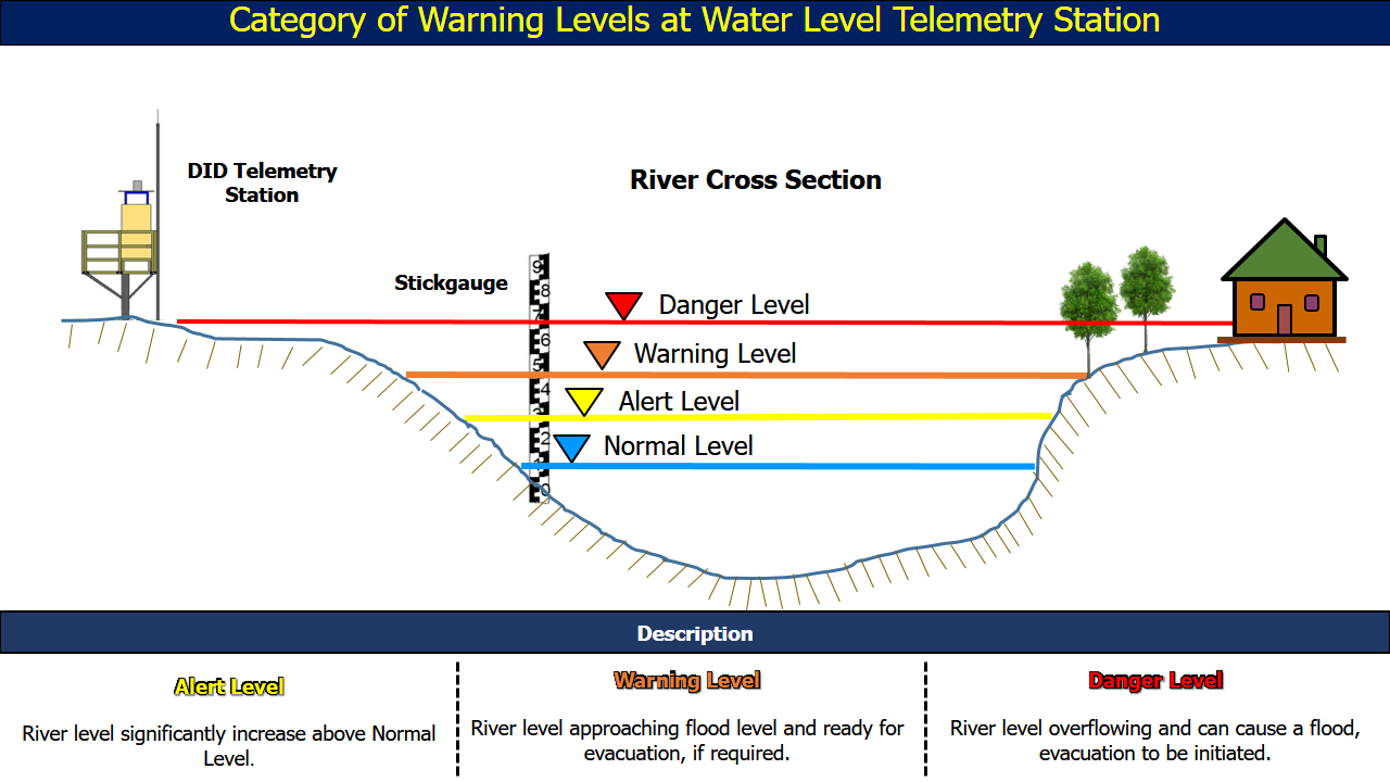
| No. | Station Name | Division | River Basin | Last Update Time | Water Level (m) | Normal Level (m) | Alert Level (m) | Warning Level (m) | Danger Level (m) |
| 106. |
Batu Niah Bazaar
|
Miri | Sungai Niah | 23-07-2026 04:15 | 0.84 | - | 2.62 | 4.72 | 5.22 |
| 107. | Bekenu •• | Miri | Sungai Sibuti | 23-07-2026 04:15 | 1.00 | - | 1.00 | 1.20 | 1.50 |
| 108. | Long Panai • | Miri | Batang Baram | 23-07-2026 04:15 | 3.91 | 2.00 | 6.50 | 7.50 | 8.00 |
| 109. | Lio Matu • | Miri | Batang Baram | 23-07-2026 04:00 | 2.47 | 0.80 | 7.00 | 8.00 | 9.00 |
| 110. |
Long Akah
|
Miri | Batang Baram | 23-07-2026 04:00 | 2.91 | 2.15 | 9.00 | 10.00 | 11.00 |
| 111. | Long Lama •• | Miri | Batang Baram | 23-07-2026 04:15 | 10.24 | 7.65 | 14.15 | 15.15 | 15.45 |
| 112. |
Benawa
|
Miri | Batang Baram | 23-07-2026 04:00 | 5.91 | 3.50 | 6.00 | 7.00 | 8.00 |
| 113. |
Long Jegan
|
Miri | Batang Baram | 23-07-2026 04:00 | 6.88 | 5.00 | 10.50 | 11.50 | 12.00 |
| 114. | Marudi •• | Miri | Batang Baram | 23-07-2026 04:15 | 1.07 | 1.08 | 2.29 | 2.46 | 2.80 |
| 115. |
Beluru
|
Miri | Batang Baram | 23-07-2026 04:15 | 4.47 | 3.60 | 5.10 | 5.60 | 5.80 |
| 116. |
Miri DID
|
Miri | Sungai Miri | 23-07-2026 04:15 | 1.72 | - | 2.50 | 2.70 | 3.00 |
| 117. | Nanga Insungai •• | Limbang | Sungai Limbang | 23-07-2026 04:00 | 6.78 | 6.50 | 8.20 | 9.10 | 11.50 |
| 118. | Long Tengoa •• | Limbang | Batang Trusan | 23-07-2026 04:00 | 44.87 | 44.30 | 46.50 | 48.00 | 50.00 |